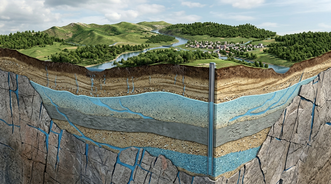
Water is one of the most important natural resources on Earth. Although rivers, lakes, and reservoirs provide visible sources of freshwater, a significant amount of the water used by people is stored beneath the ground. This underground water, known as groundwater, supports drinking water supplies, agriculture, industries, and natural ecosystems. Understanding where groundwater occurs, how it moves, and how it interacts with rocks and soil is essential for managing water resources effectively. This is where hydrogeology plays an important role.
Hydrogeology is the branch of Earth science that studies the occurrence, distribution, movement, and quality of groundwater. It combines geology, hydrology, chemistry, and environmental science to explain how water travels through the ground and how geological conditions influence its availability. By studying groundwater systems, hydrogeologists help identify reliable water sources, protect aquifers from contamination, and develop sustainable methods of groundwater management.
What Is Hydrogeology?
Hydrogeology is the scientific study of groundwater and its relationship with geological materials, including rocks, sediments, and soil. It examines how water enters the ground, where it is stored, how it moves through underground formations, and how it eventually returns to the surface or reaches other water bodies.
Unlike surface water, groundwater is not always visible. It occupies the spaces between sediment grains, the pores within certain rocks, and fractures or cracks in geological formations. The amount of water that can be stored and transmitted depends on the physical properties of these materials.
Hydrogeologists investigate these properties to understand groundwater availability in different environments. For example, a region with thick layers of permeable sand and gravel may contain a productive groundwater source, while an area dominated by dense, unfractured rock may yield very little water.
Hydrogeology also examines the interaction between groundwater and surface water. Rivers, lakes, wetlands, and groundwater systems are often connected. Changes in one system can influence the other, making their combined study important for environmental protection and water management.
What Is Groundwater?
Groundwater is water that occupies the saturated spaces within soil, sediment, and rock beneath Earth’s surface. It originates mainly from precipitation, such as rainfall and snowfall, that infiltrates the ground and gradually moves downward.
When rain falls, some water flows across the surface into streams and rivers, some evaporates, and some enters the soil. Water that moves downward through the soil and unsaturated geological materials may eventually reach the saturated zone, where the available pores and fractures are filled with water.
Groundwater can remain underground for days, years, centuries, or even longer, depending on the geological setting and the movement of water through the formation. Some groundwater systems are replenished relatively quickly, while others contain water that accumulated under different climatic conditions in the distant past.
Groundwater is important because it supplies wells and springs, supports vegetation, maintains the flow of some rivers during dry periods, and provides water to communities that have limited access to surface water.
Geological Conditions That Control Groundwater
Geology strongly influences the availability and movement of groundwater. The composition, structure, and arrangement of underground materials determine how much water can be stored and how easily it can move.
1. Porosity
Porosity is the proportion of the total volume of a geological material that consists of open spaces, called pores. These spaces can hold water, air, or other fluids.
For example, sand and gravel often contain spaces between individual grains. Some sedimentary rocks also contain pores within their structure. The amount and arrangement of these spaces influence the potential storage capacity of a formation.
However, high porosity does not automatically mean that a material can supply large quantities of groundwater. The pores must also be sufficiently connected for water to move through them.
2. Permeability
Permeability describes how easily water can flow through connected pores, fractures, or other openings in a material.
Gravel generally allows water to move more easily than clay because gravel has larger, interconnected spaces. Clay may contain considerable pore space, but its extremely small pore openings restrict water movement.
Permeability is therefore a major factor in determining whether an underground formation can provide useful quantities of groundwater to a well.
3. Fractures and Faults
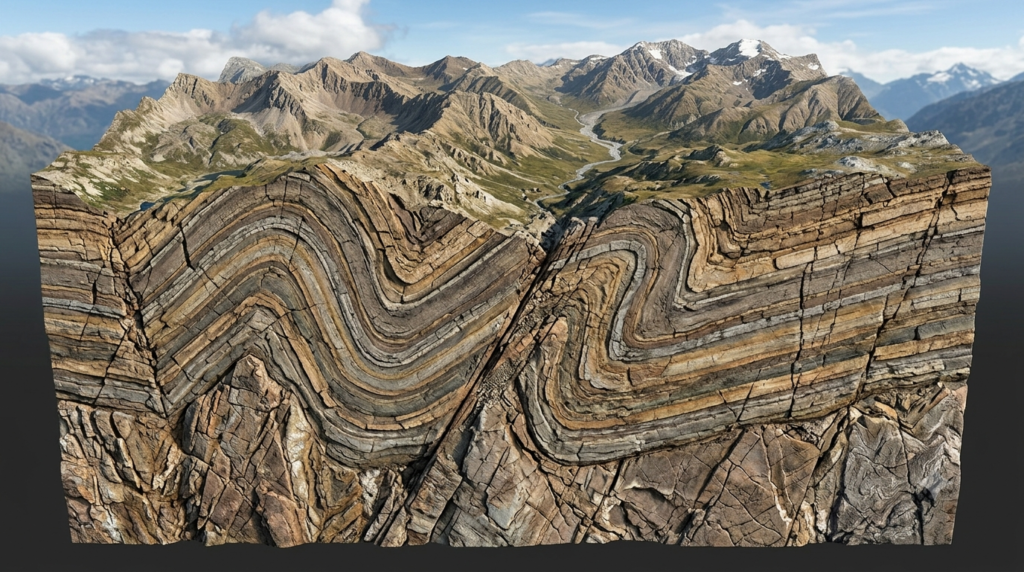
Many rocks have little primary pore space but can store and transmit groundwater through fractures, joints, and faults.
Fractures are cracks that develop in rocks because of processes such as tectonic stress, cooling, or weathering. When these openings are interconnected, they may form pathways through which groundwater can move.
In hard-rock regions, including many parts of India, groundwater availability often depends on the depth, size, connectivity, and weathering of fractures. Not every fracture contains water or transmits it efficiently, so geological investigation is important before selecting a well location.
4. Geological Layers
Underground formations are frequently arranged in layers with different physical properties. Some layers transmit water readily, while others restrict its movement.
A permeable layer enclosed by less permeable materials may form a confined groundwater system. In contrast, a permeable formation connected to the surface through its upper boundary may form an unconfined groundwater system.
Understanding the arrangement of these layers helps hydrogeologists determine groundwater depth, flow direction, storage conditions, and the possible effects of pumping.
Aquifers and Their Role in Groundwater Systems
An aquifer is a geological formation that can store and transmit enough groundwater to supply wells or springs under suitable conditions. Aquifers are among the most important features studied in hydrogeology.
Unconfined Aquifers
An unconfined aquifer has a water table as its upper boundary. The water table is the level below which the ground is generally saturated with water.
Water from rainfall can infiltrate through the ground and recharge an unconfined aquifer. Because it is relatively close to the surface, this type of aquifer can respond quickly to rainfall and groundwater pumping.
However, its proximity to the surface can also make it vulnerable to contamination from fertilizers, sewage, fuel, and other pollutants.
Confined Aquifers
A confined aquifer lies beneath a relatively low-permeability layer that restricts the movement of water into or out of the aquifer.
Water within a confined aquifer may be under pressure. When a well penetrates the formation, the water level can rise above the top of the aquifer. If the pressure is sufficient for water to flow naturally to the ground surface, the well is called a flowing artesian well.
Confined aquifers can provide important water supplies, but their recharge may occur far from the locations where water is extracted. Excessive pumping can lower pressure and reduce the sustainability of the resource.
Aquitards and Aquicludes
An aquitard is a geological layer that transmits water slowly and can restrict groundwater movement between aquifers. Clay-rich sediments commonly act as aquitards.
An aquiclude is a term traditionally used for a formation that can store water but transmits it so poorly that it provides little useful groundwater flow. In practice, geological materials often have a range of hydraulic properties rather than fitting perfectly into rigid categories.
These formations influence groundwater movement by directing water through more permeable layers and controlling connections between different groundwater systems.
How Groundwater Moves Underground
Groundwater generally moves from areas of higher hydraulic head toward areas of lower hydraulic head. Hydraulic head represents the energy available to move groundwater and is commonly related to water elevation and pressure.
The movement of groundwater depends on hydraulic gradients and the hydraulic conductivity of the geological materials through which the water travels.
In simple terms, water tends to move more readily through highly permeable materials than through materials with low permeability. The speed and direction of groundwater flow may also be influenced by geological structures, pumping wells, recharge areas, and connections with rivers or lakes.
Groundwater movement is often slower than surface-water movement. In some aquifers, water may travel only a short distance in a day, while in other settings, movement can be faster through highly permeable gravel or connected fractures.
Hydrogeologists study groundwater flow to determine how water travels from recharge areas to wells, springs, rivers, and other discharge locations. This information is useful for locating wells, predicting the movement of pollutants, and estimating how groundwater extraction may affect nearby water sources.
Groundwater Recharge and Discharge
Groundwater recharge is the process through which water enters a groundwater system. Discharge occurs when groundwater leaves the system and moves into another environment.
Groundwater Recharge
Recharge commonly occurs when rainfall or other surface water infiltrates the soil and moves downward to an aquifer. Recharge can also occur through seepage from rivers, lakes, irrigation channels, and other water bodies.
The amount of recharge depends on several factors, including rainfall intensity, soil type, land cover, slope, evaporation, and the permeability of underlying rocks.
For example, a sandy region may allow substantial infiltration, while a heavily paved urban area may direct much of its rainfall into drains rather than allowing it to enter the ground.
Artificial recharge methods, such as infiltration ponds, recharge trenches, and appropriately designed recharge wells, can help replenish groundwater where local geological conditions are suitable. However, recharge projects must be designed carefully to prevent contamination and avoid unsuitable water entering aquifers.
Groundwater Discharge
Groundwater discharge occurs when underground water flows into springs, rivers, wetlands, lakes, or the ocean. It also occurs when people extract groundwater through wells.
In some regions, groundwater maintains river flow during periods with little rainfall. This contribution is called baseflow and can be especially important during dry seasons.
Excessive groundwater pumping can reduce discharge to rivers and wetlands, lower water levels in nearby wells, and alter the natural balance between surface water and groundwater.
Studying recharge and discharge helps hydrogeologists understand whether a groundwater system is gaining water at a sustainable rate or losing water faster than it can be replenished.
Methods Used in the Geological Study of Groundwater
Hydrogeologists use several methods to investigate groundwater systems. These methods provide information about underground formations, groundwater levels, flow characteristics, and water quality.
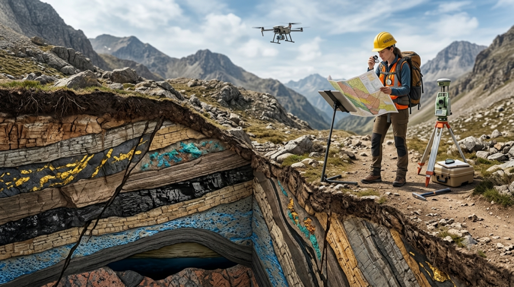
1. Geological Mapping
Geological mapping identifies the types of rocks and sediments present in an area, their distribution, and their structural features.
Hydrogeologists use geological maps to locate potentially water-bearing formations, identify fractures and faults, and understand how geological layers may influence groundwater movement.
Field observations of rock outcrops, weathering, and drainage patterns can provide valuable clues about groundwater conditions.
2. Boreholes and Well Logs
Boreholes allow scientists to examine underground materials directly. Samples collected during drilling can reveal the types and thicknesses of sediments and rocks encountered at different depths.
Well logs record information such as geological formations, drilling depth, water strikes, casing details, and groundwater levels.
By comparing logs from multiple locations, hydrogeologists can construct geological cross-sections and develop a clearer picture of the underground structure.
3. Geophysical Surveys
Geophysical methods investigate underground conditions by measuring physical properties without requiring excavation across an entire site.
Electrical resistivity surveys are widely used in groundwater exploration. They measure how strongly underground materials resist the flow of electrical current. Different combinations of rock, soil, water content, and dissolved salts can produce different resistivity values.
Other methods, including seismic surveys and electromagnetic techniques, may also be useful in appropriate settings.
Geophysical results do not directly guarantee the presence of a productive aquifer. They must be interpreted alongside geological observations and, where possible, verified by drilling and well testing.
4. Pumping Tests
Pumping tests evaluate how a well and the surrounding aquifer respond when groundwater is extracted.
During a test, water is pumped from a well while changes in water levels are measured in the pumping well and sometimes in nearby observation wells.
The results help estimate aquifer properties, including transmissivity and storage characteristics. These properties are important for evaluating potential well yields and predicting the effects of continued pumping.
5. Groundwater Level Monitoring
Groundwater levels are measured using observation wells and other monitoring equipment. Repeated measurements show how groundwater conditions change over time.
A rising water level may indicate increased recharge or reduced extraction, although local conditions must be considered. A declining water level may indicate drought, excessive pumping, reduced recharge, or a combination of factors.
Long-term monitoring helps identify seasonal patterns and provides early warning of groundwater stress.
6. Groundwater Quality Testing
Groundwater quality is assessed by collecting samples and analyzing their physical, chemical, and sometimes biological characteristics.
Common measurements include pH, electrical conductivity, dissolved salts, hardness, and concentrations of specific chemical constituents. Tests for bacteria and other contaminants may also be necessary when groundwater is used for drinking.
The results help determine whether groundwater is suitable for drinking, irrigation, industrial use, or other purposes. They can also help identify possible contamination sources and natural geological influences on water chemistry.
The Importance of Hydrogeology
Hydrogeology has practical applications in many areas of modern life.
Drinking Water Supply
Many rural communities, towns, and cities depend on groundwater for drinking and domestic purposes. Hydrogeological investigations help identify suitable well locations and assess whether an aquifer can provide an adequate supply.
They also help protect water sources from contamination and reduce the risk of drilling unsuccessful wells.
Agriculture and Irrigation
Groundwater is an important source of irrigation water in many agricultural regions. Farmers often depend on wells during dry periods when rainfall and surface-water supplies are insufficient.
Hydrogeological studies help estimate groundwater availability and identify areas where excessive pumping may threaten long-term agricultural productivity.
Environmental Protection
Groundwater supports springs, wetlands, and river ecosystems. Changes in groundwater levels can affect vegetation, wildlife habitats, and the flow of water into surface environments.
Hydrogeologists investigate these connections to help protect ecosystems and understand the environmental consequences of groundwater extraction.
Pollution Control
Groundwater contamination can occur when harmful substances enter the ground from industrial waste, leaking storage tanks, poorly managed sewage systems, agricultural chemicals, or contaminated surface water.
Hydrogeologists study groundwater flow and geological conditions to predict how pollutants may spread. Their findings support monitoring programs, contamination control, and groundwater remediation projects.
Construction and Engineering
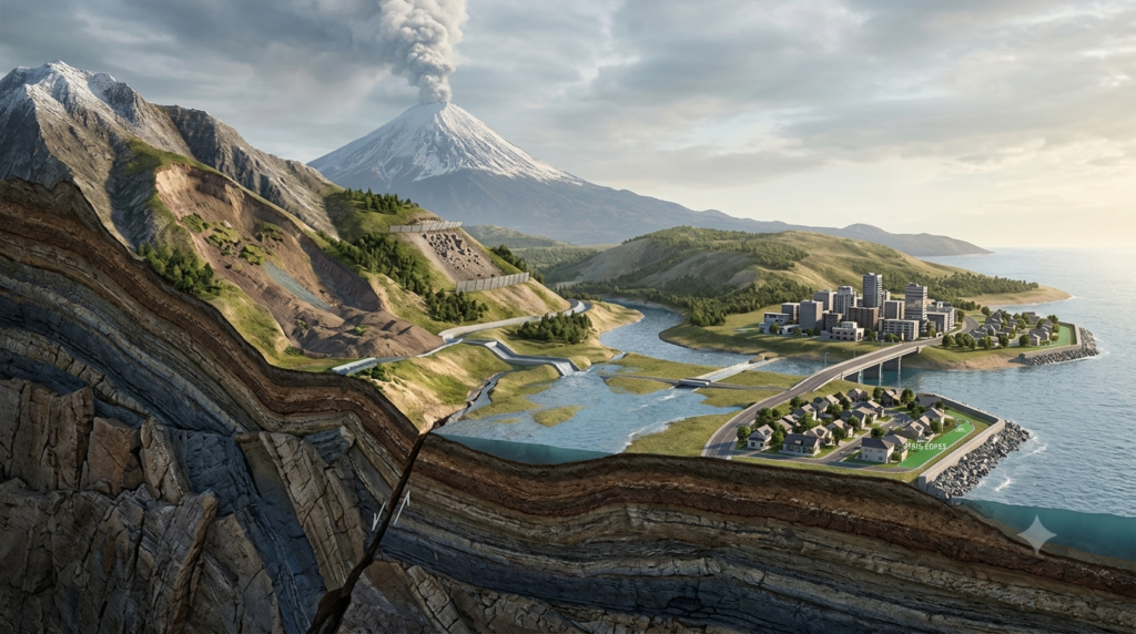
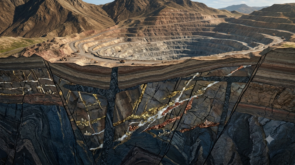
Groundwater conditions can affect the design and construction of buildings, tunnels, dams, roads, mines, and underground structures.
High groundwater levels may create water pressure, cause excavation difficulties, or contribute to slope instability. Hydrogeological investigations help engineers plan drainage systems, manage groundwater inflow, and reduce construction risks.
Climate Change and Drought Management
Changes in rainfall patterns, evaporation, and temperature can influence groundwater recharge and demand.
Hydrogeology helps scientists evaluate how groundwater systems respond to prolonged droughts, changing precipitation patterns, and increasing water consumption. This knowledge supports planning for periods when surface-water supplies become unreliable.
Hydrogeology in India
Groundwater plays a major role in India’s water supply, particularly in agriculture and rural drinking-water systems. However, groundwater availability varies widely because the country’s geological formations, rainfall patterns, and climatic conditions differ from region to region.
In the Indo-Gangetic plains, groundwater is often stored in thick layers of sand, silt, and gravel deposited by rivers. These alluvial formations can support productive aquifers, although local water quality and pumping conditions vary.
In much of peninsular India, groundwater occurs within weathered and fractured hard rocks, including granite, gneiss, basalt, and other crystalline or volcanic formations. In these regions, the location and connectivity of fractures can strongly influence well performance.
Basaltic formations in parts of Maharashtra illustrate the importance of understanding local geology. Groundwater may occur in weathered zones, fractures, and certain permeable layers within the basalt sequence. Because these features are not distributed uniformly, some wells produce substantial water while nearby wells may have limited yields.
Groundwater challenges in India include declining water levels in heavily pumped areas, contamination by naturally occurring or human-introduced substances, and seasonal shortages. Hydrogeological mapping, rainwater harvesting, groundwater monitoring, and locally appropriate recharge measures can contribute to more sustainable management.
Challenges in Groundwater Management
Despite its importance, groundwater is difficult to manage because it lies beneath the surface and cannot always be observed directly.
One major challenge is over-extraction. When groundwater is pumped faster than it is replenished over an extended period, water levels may decline. This can increase pumping costs, reduce well yields, and cause shallow wells to dry up.
Another challenge is contamination. Pollutants may travel through permeable geological layers and enter groundwater systems. Some contaminants are difficult and expensive to remove once they have spread underground.
Groundwater recharge is also uneven. Areas with similar rainfall can have very different recharge rates because of differences in soil, geology, vegetation, and land use. In addition, groundwater may take a long time to move from recharge areas to extraction points, making the effects of poor management difficult to reverse quickly.
Effective groundwater management therefore requires reliable data, careful planning, pollution prevention, and cooperation among communities, farmers, scientists, engineers, and government agencies.
The Future of Hydrogeology
Modern technology is improving the way groundwater systems are investigated and managed. Geographic Information Systems (GIS), satellite observations, remote sensing, computer modeling, and automated monitoring instruments help scientists analyze large amounts of environmental data.
Satellite-based observations can provide information about broad changes in water storage, although they generally cannot determine the condition of an individual well or a small local aquifer by themselves.
Groundwater models allow hydrogeologists to simulate how water levels and flow patterns may respond to different rainfall conditions, pumping rates, and management strategies. These models are valuable planning tools, but their reliability depends on the quality of the available data and the assumptions used.
Future groundwater management will increasingly require an integrated approach that considers surface water, groundwater, land use, water quality, climate, and human demand together.
Public awareness will also remain important. Preventing contamination, using water efficiently, maintaining recharge areas, and monitoring groundwater levels can help protect underground water resources for future generations.
Conclusion
Hydrogeology is an essential branch of Earth science that explains how groundwater is stored, how it moves through geological formations, and how it interacts with the environment. By studying porosity, permeability, aquifers, fractures, recharge, discharge, and groundwater quality, hydrogeologists help society understand and manage an important freshwater resource.
Its applications extend from drinking-water supply and agriculture to engineering, pollution control, and climate adaptation. In countries such as India, where groundwater supports millions of people and a large agricultural sector, geological investigations are especially important for identifying suitable water sources and preventing over-extraction.
As water demand increases and climate conditions change, the need for accurate groundwater information will continue to grow. Through scientific investigation, responsible planning, and sustainable use, hydrogeology can help protect groundwater resources and maintain their availability for future generations.
FAQs
1. What is hydrogeology?
Hydrogeology is the branch of Earth science that studies groundwater, including its occurrence, distribution, movement, storage, and quality. It examines how water interacts with rocks, soil, sediments, and geological structures beneath Earth’s surface. Hydrogeologists investigate underground water resources to understand where groundwater is located and how it can be used sustainably. Their work involves geological mapping, groundwater monitoring, borehole investigations, water quality testing, and computer modeling. Hydrogeology is important for drinking water supplies, agriculture, environmental protection, and engineering projects. It also helps scientists understand groundwater contamination, drought impacts, and the long-term effects of excessive groundwater extraction.
2. What is the difference between hydrogeology and hydrology?
Hydrology is the broader science of water, including its movement, distribution, and properties across Earth’s surface and within the water cycle. It studies rainfall, evaporation, rivers, lakes, snow, and other aspects of water movement. Hydrogeology focuses specifically on groundwater and its relationship with geological formations. It examines how water enters the ground, moves through pores and fractures, and accumulates in aquifers. Although their main areas of study differ, the two sciences are closely connected. For example, understanding how rainfall recharges groundwater requires knowledge of both hydrology and the geological properties of the underlying materials.
3. How is groundwater formed?
Groundwater develops mainly when precipitation, such as rain or melting snow, infiltrates the ground and moves downward through soil and geological materials. As water travels deeper, it may eventually reach the saturated zone, where the available pores and fractures are filled with water. Some groundwater also enters underground formations through seepage from rivers, lakes, and other surface-water bodies. The amount of groundwater that accumulates depends on rainfall, soil characteristics, rock permeability, land cover, and evaporation. Groundwater may remain underground for relatively short periods or for thousands of years. Its availability depends on the balance between recharge, natural discharge, and human extraction.
4. What is an aquifer, and why is it important?
An aquifer is a geological formation that stores and transmits enough groundwater to supply wells or springs under suitable conditions. Aquifers may consist of sand, gravel, porous sedimentary rocks, or fractured hard rocks. They are important because they provide water for drinking, irrigation, industrial activities, and various environmental needs. Aquifers can be classified as unconfined or confined, depending on their geological boundaries and pressure conditions. Their ability to supply water depends on properties such as permeability, porosity, thickness, and groundwater recharge. Protecting aquifers from contamination and excessive pumping is essential for maintaining reliable water supplies over the long term.
5. What geological factors affect groundwater availability?
Groundwater availability depends on several geological factors, including porosity, permeability, rock type, fractures, faults, weathering, and the arrangement of underground layers. Porosity determines how much water a material can potentially store, while permeability influences how easily water can flow through connected openings. Sand and gravel often transmit groundwater effectively, whereas clay generally restricts water movement. In hard-rock regions, groundwater may be concentrated in weathered zones and interconnected fractures. Geological structures can direct groundwater flow or restrict movement between formations. Rainfall, recharge conditions, and groundwater extraction also influence availability. Studying these factors helps hydrogeologists identify suitable locations for wells.
6. How do hydrogeologists locate groundwater?
Hydrogeologists locate potential groundwater sources by combining geological observations with scientific investigation methods. They study geological maps, rock formations, soil characteristics, drainage patterns, fractures, and topography to identify areas that may contain aquifers. Geophysical techniques, such as electrical resistivity surveys, help investigate underground conditions without extensive drilling. Boreholes and well logs provide direct information about the materials beneath the surface. After identifying a promising location, drilling and pumping tests can help determine whether the formation can supply useful quantities of water. No single method guarantees success, so combining geological, geophysical, and field evidence generally provides a more reliable assessment.
7. What is the difference between porosity and permeability?
Porosity and permeability are two important properties used to understand groundwater storage and movement. Porosity refers to the proportion of a material’s total volume occupied by pores or open spaces. It indicates the potential space available for storing water. Permeability describes how easily water can move through connected pores, fractures, or openings. A material may have high porosity but low permeability if its pores are extremely small or poorly connected. For example, clay can hold water within its pore spaces but usually transmits it slowly. Gravel often has both substantial pore space and good connectivity, allowing groundwater to flow more readily.
8. How does groundwater contamination occur?
Groundwater contamination occurs when harmful substances enter underground water systems and reduce their quality. Common sources include leaking fuel tanks, untreated sewage, industrial waste, agricultural fertilizers, pesticides, and poorly managed landfills. Contaminants can move downward through soil and permeable geological formations, eventually reaching an aquifer. Their movement depends on groundwater flow, geological properties, chemical reactions, and the nature of the pollutant. Some contaminants spread quickly, while others remain concentrated near their source or persist underground for long periods. Preventing contamination requires proper waste disposal, sanitation, chemical management, and regular water quality testing. Cleaning contaminated groundwater can be technically difficult and expensive.
9. Why is hydrogeology important in India?
Hydrogeology is particularly important in India because groundwater supplies a substantial share of the water used for irrigation, drinking, and domestic purposes. Geological conditions vary considerably across the country. The Indo-Gangetic plains contain extensive alluvial formations, while many peninsular regions depend on groundwater stored in weathered and fractured hard rocks. These differences affect groundwater availability, well productivity, and recharge. Hydrogeological investigations help identify suitable drilling locations, monitor declining water levels, evaluate water quality, and plan recharge projects. They also support the sustainable management of groundwater in areas affected by drought, contamination, or excessive pumping, helping communities protect their long-term water resources.
10. How can groundwater resources be managed sustainably?
Sustainable groundwater management involves balancing water extraction with natural and managed recharge while protecting water quality. Important measures include monitoring groundwater levels, improving irrigation efficiency, repairing leaking water systems, protecting recharge areas, and preventing the release of pollutants into the environment. Rainwater harvesting and carefully designed recharge structures can help replenish aquifers where geological conditions are suitable. Authorities and communities should also evaluate local groundwater availability before approving large-scale extraction. In heavily stressed areas, reducing pumping may be necessary to allow water levels to recover. Combining scientific monitoring, responsible consumption, public awareness, and effective planning helps maintain groundwater supplies for future generations.