Natural resources play an essential role in everyday life. The minerals used in smartphones, the metals required for buildings, the coal and natural gas used for energy, and the groundwater that supplies homes and farms all come from the Earth. However, these resources are not distributed evenly across the planet. Some are found near the surface, while others remain buried deep beneath layers of rock, soil, and sediment. Discovering them requires scientific knowledge, careful observation, and advanced technology. This is where geological surveys become important. Geological surveys help scientists understand the structure, composition, and history of the Earth’s crust to identify areas that may contain valuable natural resources. By combining field investigations, geological mapping, geophysical measurements, geochemical testing, and modern computer technology, researchers can locate potential deposits more efficiently. These surveys also help evaluate environmental risks and support the responsible management of natural resources.
What Is a Geological Survey?
A geological survey is a systematic scientific investigation of the Earth’s surface and subsurface. It involves collecting and analyzing information about rocks, minerals, soil, landforms, geological structures, and other features that reveal how the Earth is formed and how it has changed over time.
Geological surveys may be conducted over a small area, such as a proposed mining site, or across an entire region or country. Their objectives depend on the purpose of the investigation. Some surveys focus on understanding earthquakes and landslides, while others investigate groundwater, mineral deposits, petroleum, natural gas, or construction materials.
When the main objective is to discover natural resources, geologists examine the geological conditions that allow particular resources to form and accumulate. For example, certain minerals are associated with specific rock types, while petroleum accumulates in suitable sedimentary basins under particular geological conditions.
A geological survey does not automatically confirm the presence of an economically useful resource. Instead, it identifies promising areas, reduces uncertainty, and guides further exploration.
Why Geological Surveys Are Important for Discovering Natural Resources
Natural resources are often hidden beneath the Earth’s surface. Exploring every location through drilling or excavation would be expensive, time-consuming, and potentially harmful to the environment.
Geological surveys help solve this problem by providing scientific evidence about where resources are most likely to occur.
Identifying Resource-Rich Areas
Different natural resources form under different geological conditions. Gold may occur in quartz veins or ancient river sediments, while iron ore can develop through several geological processes, including the formation of banded iron formations. Petroleum commonly accumulates in sedimentary basins where suitable source rocks, reservoir rocks, seals, and traps are present.
By studying these conditions, geologists can identify locations that have a higher probability of containing particular resources.
Reducing Exploration Costs
Mining and energy exploration can require substantial financial investment. Geological surveys help companies and government agencies narrow their search to areas with favorable geological characteristics.
Instead of drilling randomly across a large region, exploration teams can use survey results to select more promising locations for detailed investigation. This approach saves time, reduces unnecessary drilling, and improves the efficiency of resource exploration.
Supporting Resource Planning
Governments need reliable geological information to plan mining activities, groundwater development, energy production, and infrastructure projects.
Survey results help decision-makers understand the distribution of available resources and assess whether further exploration is justified. They also provide important information for long-term resource management.
Major Methods Used in Geological Surveys
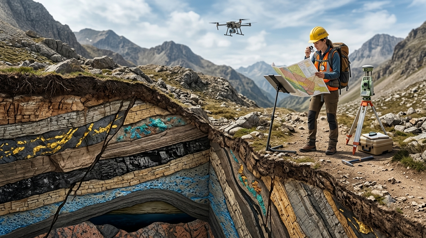
Geologists use several complementary methods to investigate the Earth’s surface and subsurface. The choice of method depends on the resource being investigated, the geological setting, the depth of the target, and the available budget.
1. Geological Mapping
Geological mapping is one of the most fundamental methods used in resource exploration. It involves identifying and recording the distribution of different rock types, geological formations, faults, folds, and other structures within a particular area.
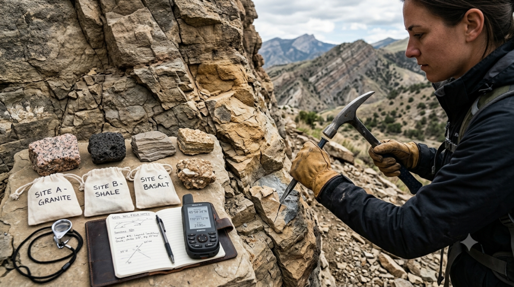
Geologists visit field locations, examine exposed rocks, collect samples, and record their observations using maps and digital positioning tools. They may also study cliffs, riverbanks, road cuttings, quarries, and other locations where rock layers are visible.
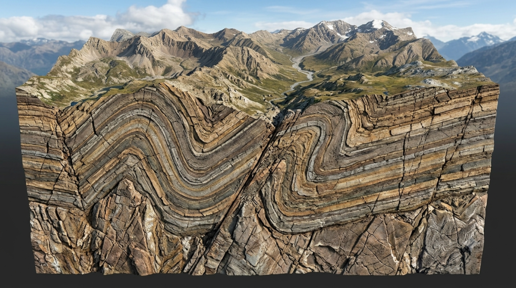
Geological maps show how different rock formations are distributed across a region. They can reveal structures associated with mineralization, such as fractures and faults that allow mineral-rich fluids to move through rocks.
For example, a geological map may reveal that an area contains ancient volcanic rocks and fractures commonly associated with certain metallic mineral deposits. This information can help scientists identify locations for more detailed mineral exploration.
Geological mapping is also useful for understanding coal-bearing formations, sedimentary basins, groundwater-bearing rocks, and deposits of construction materials.
2. Geophysical Surveys
Geophysical surveys investigate the physical properties of rocks and underground structures without requiring extensive excavation. These methods measure characteristics such as magnetic response, electrical conductivity, density, and the movement of seismic waves.
Different rocks and minerals have different physical properties. Scientists use these differences to identify underground features that may indicate the presence of natural resources.
Common geophysical methods include:
Magnetic surveys: Measure variations in the Earth’s magnetic field caused by magnetic minerals and geological structures. They are useful for investigating certain iron-rich formations and mapping buried geological features.
Gravity surveys: Measure small variations in gravitational acceleration caused by differences in underground rock density. These measurements can help identify sedimentary basins, dense rock bodies, and other geological structures.
Electrical and electromagnetic surveys: Investigate differences in electrical conductivity and resistivity. They can help locate some conductive mineral deposits and identify geological conditions relevant to groundwater exploration.
Seismic surveys: Use artificially generated or naturally occurring seismic waves to investigate underground structures. They are particularly important in petroleum exploration and are also used to study geological layers and faults.
Geophysical measurements usually provide indirect evidence. A magnetic or electrical anomaly does not necessarily mean that a valuable mineral deposit exists. Geologists must interpret the results alongside other geological information and confirm promising targets through additional investigation.
3. Geochemical Surveys
Geochemical surveys involve analyzing the chemical composition of rocks, soil, stream sediments, groundwater, or other environmental samples.
Some mineral deposits release small quantities of characteristic elements into the surrounding environment. These elements may accumulate in nearby soils or sediments, creating chemical patterns that can help identify hidden deposits.
For example, elevated concentrations of copper, lead, zinc, or other elements may indicate mineralization in a particular area. Gold exploration may involve analyzing samples for gold and associated indicator elements, depending on the geological setting.
The general process includes collecting samples from carefully selected locations, recording their positions, preparing them for laboratory analysis, and interpreting the resulting chemical data.
Geochemical surveys can identify subtle clues that are not visible on the surface. However, unusual chemical concentrations can also result from natural background variation, contamination, or unrelated geological processes. Scientists therefore compare results with local background levels and other geological evidence.
4. Remote Sensing and Satellite Imagery
Remote sensing allows scientists to investigate large areas using information collected by satellites, aircraft, drones, and other sensors.
Satellite images can reveal landforms, rock exposures, vegetation patterns, drainage systems, and surface changes. Certain sensors also record information beyond visible light, helping scientists distinguish surface materials that may appear similar to the human eye.
Multispectral and hyperspectral imagery can help identify some minerals through their characteristic interactions with electromagnetic radiation. For example, particular alteration minerals associated with hydrothermal activity may produce recognizable spectral patterns.
Remote sensing is especially valuable in mountainous regions, deserts, forests, and other areas where field investigations are difficult.
However, vegetation, soil cover, weathering, and human activity can hide important geological features. Satellite imagery is therefore usually combined with field mapping, geophysical measurements, and laboratory testing.
5. Drilling and Subsurface Sampling
After preliminary surveys identify a promising location, drilling may be used to investigate the rocks beneath the surface directly.
Exploration drilling produces samples that reveal the types of rocks, their depth, thickness, and mineral content. Depending on the drilling method, investigators may recover rock cores or collect rock fragments and other samples.
Core samples are particularly useful because they preserve a continuous section of the rock formations encountered along the borehole. Geologists examine these samples to identify mineralization, geological structures, alteration, and changes between rock layers.
For mineral exploration, drilling helps determine whether a suspected deposit actually exists and how it is distributed underground. In petroleum exploration, wells can provide information about reservoir rocks, fluids, pressure, and other properties.
Drilling is more expensive than many preliminary survey methods. For this reason, geological mapping, geophysical surveys, geochemical analysis, and other investigations are often used first to select appropriate drilling targets.
How Geological Surveys Help Discover Different Natural Resources
Different resources require different exploration strategies because they form through different geological processes.
Mineral Resources
Mineral resources include metallic minerals, industrial minerals, and precious metals. Examples include iron ore, copper, bauxite, lithium-bearing minerals, gold, limestone, and phosphate rock.
Geologists investigate the rock types, geological structures, and mineral-forming processes associated with these materials. Geological mapping may reveal favorable formations, while geochemical and geophysical surveys help identify possible mineral concentrations.
For example, exploration for copper may involve examining volcanic or sedimentary formations, mapping alteration zones, and searching for geochemical or geophysical anomalies. Drilling can then help establish the distribution and characteristics of a potential deposit.
The results help determine whether further exploration is justified and whether a deposit may eventually support mining.
Petroleum and Natural Gas
Petroleum and natural gas generally form from organic matter that has been buried and transformed by heat and pressure over geological time.
Their accumulation usually requires several conditions: a source rock capable of generating hydrocarbons, a reservoir rock with suitable pore space and permeability, a seal that prevents fluids from escaping, and a geological trap or other accumulation mechanism.
Geological surveys help identify sedimentary basins and investigate the structures within them. Seismic surveys are especially important because they can produce detailed images of underground rock layers.
Geologists interpret these images to identify structures that may contain hydrocarbons. Additional geological studies and exploratory drilling are needed to determine whether petroleum or natural gas is present in commercially useful quantities.
Not every promising geological structure contains a productive reservoir. Exploration results must be evaluated carefully before development begins.
Groundwater Resources
Groundwater is one of the most important natural resources because it supports drinking-water supplies, agriculture, industry, and ecosystems.
Geological surveys help identify aquifers, which are geological formations capable of storing and transmitting usable quantities of groundwater. Sand, gravel, fractured rocks, and certain types of porous sedimentary formations can serve as aquifers.
Geologists examine rock types, fractures, geological structures, surface drainage, and the relationship between landforms and underground water movement. Geophysical techniques can help investigate subsurface layers and identify possible water-bearing formations.
Test wells and pumping tests may then be used to assess water availability, aquifer properties, and well performance.
Finding groundwater is only part of the process. Scientists must also evaluate water quality, recharge rates, seasonal changes, and the risk of over-extraction. A productive well does not guarantee that groundwater can be withdrawn sustainably over the long term.
Coal and Other Energy Resources
Coal deposits are commonly associated with sedimentary formations containing ancient plant material. Geological surveys help map coal-bearing layers and investigate their thickness, depth, continuity, and structural conditions.
These findings support estimates of the potential size of coal deposits and help determine whether more detailed exploration is appropriate.
Geological investigations also contribute to the exploration of geothermal energy. Geothermal resources depend on underground heat, suitable rock properties, and the availability of fluids or other systems that can transfer heat effectively.
Scientists investigate temperature gradients, faults, geological formations, and evidence of hydrothermal activity to identify promising locations for geothermal development.
Construction Materials
Resources such as sand, gravel, clay, limestone, granite, and other building stones are essential for roads, houses, bridges, and other infrastructure.
Geological surveys help identify deposits suitable for construction and assess their physical characteristics, distribution, and accessibility.
For example, limestone may be investigated for cement production, while granite and other durable rocks may be assessed for use as building stone or aggregate. Laboratory tests are often required to determine strength, durability, chemical composition, and suitability for a particular application.
The location of a deposit also matters. Transportation costs, land availability, environmental restrictions, and proximity to construction markets can strongly influence whether extraction is practical.
The Role of Modern Technology in Geological Surveys
Modern geological surveys increasingly combine traditional fieldwork with advanced digital tools. These technologies allow scientists to process large amounts of information, compare different datasets, and identify patterns that might otherwise remain difficult to recognize.
Geographic Information Systems
Geographic Information Systems (GIS) allow geologists to organize, analyze, and display spatial information in digital maps.
A GIS project may combine geological formations, mineral occurrences, satellite imagery, topography, roads, water resources, and geophysical measurements in one system.
By comparing these layers, researchers can identify areas where several independent indicators suggest favorable conditions for a particular resource.
GIS also helps exploration teams plan fieldwork, document sample locations, and communicate findings to government agencies and other stakeholders.
Three-Dimensional Geological Modeling
Three-dimensional geological modeling uses geological maps, borehole data, seismic interpretations, and other measurements to construct digital representations of underground formations.
These models help scientists visualize how rock layers extend beneath the surface and how faults, folds, and mineralized zones relate to one another.
A three-dimensional model can improve the interpretation of drilling results and guide decisions about where additional boreholes should be placed. However, its reliability depends on the quality and quantity of the available data.
Artificial Intelligence and Data Analysis
Artificial intelligence and machine learning can help analyze large geological datasets and identify relationships between geological features and known resource deposits.
For example, computer models may combine satellite imagery, geochemical measurements, geological maps, and geophysical data to rank areas according to their potential for mineralization.
These tools can make exploration more efficient, but they do not replace geological expertise. Predictions may be affected by incomplete data, biased training examples, or similarities that do not reflect the actual presence of a resource.
Field verification and scientific interpretation remain essential.
From Geological Survey to Resource Development
Discovering a potential resource is a multi-stage process. Geological surveys form an important part of this process, but they are not the final step.
The general sequence often includes the following stages.
Stage 1: Regional assessment
Scientists review existing geological maps, historical exploration records, satellite imagery, and other available information to identify areas of interest.
Stage 2: Preliminary field investigation
Geologists examine exposed rocks, collect samples, and record geological features to evaluate whether the region has favorable conditions for a resource.
Stage 3: Detailed exploration
Geochemical and geophysical surveys are conducted to investigate promising locations more closely. The results help define targets for further study.
Stage 4: Drilling and sampling
Exploration drilling provides direct information about underground formations and helps confirm the presence, depth, and distribution of a potential deposit.
Stage 5: Resource estimation
Scientists and technical specialists use geological observations, sample analyses, drilling results, and appropriate estimation methods to assess the quantity and quality of the identified material.
Stage 6: Feasibility and environmental assessment
Before development, specialists evaluate technical feasibility, costs, infrastructure, environmental impacts, legal requirements, and other relevant factors.
Stage 7: Responsible development and monitoring
If a project is approved, extraction or production may begin under applicable regulations. Continued monitoring helps manage environmental impacts and supports the responsible use of resources.
A geological discovery does not automatically mean that mining or extraction will occur. Some deposits are too small, too deep, too costly to develop, or too environmentally sensitive to exploit economically or responsibly.
Environmental Importance of Geological Surveys
Geological surveys are not only about finding resources. They can also help reduce the environmental risks associated with resource development.
Before a mining or drilling project begins, geological investigations can identify groundwater systems, unstable slopes, fault zones, and other important features. This information helps planners assess potential hazards and design appropriate safeguards.
Surveys can also help identify environmentally sensitive areas where extraction may create unacceptable impacts. Information about aquifers and groundwater flow is particularly important when evaluating the risk of contamination or changes in water availability.
In some cases, geological studies help identify naturally occurring hazardous substances, such as arsenic-bearing minerals, that could affect water quality if disturbed.
After extraction ends, geological information can support land restoration, slope stabilization, and the monitoring of groundwater and surface conditions.
Although surveys cannot eliminate every environmental risk, they provide evidence that can improve planning and decision-making.
Challenges and Limitations of Geological Surveys
Despite advances in technology, geological surveys have several limitations.
One major challenge is that many resources are buried deep underground. Surface observations may provide only indirect clues about what lies beneath the Earth’s crust.
Another challenge is geological complexity. Faults, folds, weathering, and variations in rock composition can make it difficult to interpret survey results accurately.
Remote areas may be difficult to access because of steep terrain, dense vegetation, extreme weather, or limited infrastructure. These conditions can increase the cost and duration of field investigations.
Geophysical and geochemical anomalies may also produce misleading results. A detected signal may indicate a geological feature unrelated to the resource being investigated. Consequently, different methods must often be combined to develop a reliable interpretation.
Finally, discovering a deposit does not guarantee that it is economically recoverable. Its depth, concentration, size, extraction requirements, environmental consequences, and market conditions all influence its practical value.
These limitations make careful data collection, independent verification, and transparent reporting essential parts of resource exploration.
Conclusion
Geological surveys are essential tools for discovering and evaluating the natural resources that support modern society. By studying rocks, geological structures, chemical compositions, underground physical properties, and subsurface formations, scientists can identify areas that may contain valuable minerals, petroleum, natural gas, groundwater, coal, geothermal energy, and construction materials. Methods such as geological mapping, geophysical surveys, geochemical analysis, remote sensing, and exploratory drilling provide complementary information about the Earth’s resources. Modern technologies, including GIS, three-dimensional modeling, and artificial intelligence, further improve the interpretation of geological data. However, potential discoveries must be verified and evaluated before resources can be developed. When combined with environmental assessment and responsible planning, geological surveys help reduce exploration uncertainty, guide investment, and support the sustainable management of Earth’s valuable natural resources.
FAQs
1. What is a geological survey?
A geological survey is a scientific investigation of the Earth’s surface and subsurface to understand rock types, minerals, geological structures, and other natural features. Scientists collect information through field observations, geological mapping, rock sampling, geophysical measurements, and laboratory analysis. Geological surveys help identify areas that may contain valuable natural resources, including minerals, petroleum, natural gas, groundwater, and construction materials. They also provide information about geological hazards and environmental conditions. By studying geological evidence, researchers can understand how resources are distributed and determine where further exploration may be useful. Geological surveys support scientific research, economic planning, and responsible resource management.
2. How do geological surveys help discover mineral deposits?
Geological surveys help discover mineral deposits by identifying rock formations and geological conditions associated with mineral formation. Geologists examine surface rocks, map faults and fractures, collect soil and rock samples, and analyze their chemical composition. Geophysical surveys can detect variations in magnetic properties, density, or electrical conductivity that may indicate buried mineralization. These different sources of evidence help researchers identify promising exploration targets. If the results are encouraging, drilling may be conducted to examine underground rocks and confirm the presence of minerals. Geological surveys reduce uncertainty and help exploration teams focus their efforts on locations with favorable geological characteristics rather than searching randomly.
3. What are the main methods used in geological surveys?
The main methods used in geological surveys include geological mapping, geophysical surveys, geochemical surveys, remote sensing, and exploratory drilling. Geological mapping identifies rock formations and structures at the surface. Geophysical surveys measure underground physical properties, while geochemical surveys analyze elements in rocks, soils, sediments, and water. Remote sensing uses satellite imagery and aerial observations to investigate large areas. Exploratory drilling provides direct samples of underground formations. Scientists often combine these methods because each provides different information about the Earth’s structure and resources. The choice of method depends on the target resource, geological conditions, exploration budget, and the depth at which the resource may occur.
4. How do geophysical surveys help locate underground resources?
Geophysical surveys help locate underground resources by measuring physical properties of rocks and geological formations. Magnetic surveys identify variations in magnetic fields, gravity surveys measure differences in gravitational acceleration, and electrical surveys investigate subsurface conductivity and resistivity. Seismic surveys analyze the movement and reflection of waves through underground rock layers. These measurements can reveal geological structures associated with mineral deposits, petroleum reservoirs, groundwater systems, and other resources. However, geophysical surveys generally provide indirect evidence rather than direct confirmation. An unusual measurement may have several possible geological explanations. Scientists therefore compare geophysical results with geological maps, chemical analyses, and drilling samples before drawing reliable conclusions.
5. What role do geological surveys play in groundwater exploration?
Geological surveys help locate groundwater by identifying aquifers and studying the geological conditions that control underground water movement. Geologists examine rock types, fractures, sediment layers, landforms, and drainage patterns to understand where water may accumulate. Geophysical methods can help investigate underground formations and identify potential water-bearing zones. After promising locations are identified, test wells and pumping tests may be used to evaluate water availability and aquifer performance. Scientists also examine water quality and the rate at which groundwater is naturally replenished. These investigations help communities, farmers, and planners make informed decisions about water supplies. Sustainable groundwater management requires preventing contamination and avoiding excessive extraction.
6. How do satellite images help in geological surveys?
Satellite images help geologists investigate large areas efficiently by revealing landforms, surface rock exposures, drainage patterns, and other geological features. Specialized sensors can record information across different wavelengths of electromagnetic radiation, allowing scientists to identify certain minerals and alteration zones that may not be easily distinguished in ordinary photographs. Remote sensing is particularly useful in remote mountains, deserts, and regions where field access is difficult. Researchers combine satellite imagery with geological maps, field observations, geochemical measurements, and geophysical data to identify promising exploration areas. However, vegetation, soil, weathering, and surface development can hide geological features. Satellite observations therefore guide investigations but rarely provide complete confirmation of underground resources.
7. How do geological surveys help discover petroleum and natural gas?
Geological surveys help discover petroleum and natural gas by identifying sedimentary basins and geological structures that may contain accumulated hydrocarbons. Scientists investigate source rocks, reservoir rocks, sealing layers, and potential traps where petroleum or gas could collect. Seismic surveys are especially important because they help create images of underground rock formations. Geologists interpret these images alongside existing geological information to select promising locations for exploratory drilling. Drilling provides direct evidence about underground formations and may reveal hydrocarbons and reservoir properties. However, not every promising structure contains commercially recoverable petroleum or natural gas. Further testing and economic evaluation are necessary before a discovery can lead to production.
8. How do geological surveys reduce the cost of resource exploration?
Geological surveys reduce exploration costs by helping scientists identify promising locations before expensive drilling or excavation begins. Preliminary investigations use geological maps, satellite imagery, field observations, and geophysical or geochemical measurements to narrow the search area. This allows exploration teams to concentrate resources on locations supported by stronger geological evidence. Better targeting can reduce unnecessary drilling, equipment use, transportation, and fieldwork. Geological information also helps organizations compare different exploration sites and plan investigations more efficiently. Although surveys require time and financial investment, they can reduce uncertainty and improve decision-making. They cannot eliminate exploration failures, but they help make the search for natural resources more systematic.
9. How do geological surveys help protect the environment?
Geological surveys help protect the environment by providing information about groundwater systems, unstable slopes, geological hazards, and sensitive land formations before resource development begins. This information helps planners identify potential risks associated with mining, drilling, and construction. Surveys can support the assessment of groundwater contamination, slope instability, and the disturbance of naturally occurring hazardous minerals. They also help identify areas where extraction may create unacceptable environmental damage. After mining or other activities end, geological data can assist with land restoration and environmental monitoring. Geological surveys alone cannot prevent every environmental problem, but they provide essential scientific evidence for safer planning, regulatory decisions, and responsible natural resource management.
10. Do geological surveys guarantee the discovery of natural resources?
No, geological surveys do not guarantee the discovery of natural resources. They identify geological conditions and patterns that suggest where resources may occur, but these indicators do not always lead to a successful discovery. For example, a geophysical anomaly may result from an ordinary rock formation rather than a valuable mineral deposit. Similarly, a promising geological structure may not contain petroleum in recoverable quantities. Even when a resource is discovered, its concentration, depth, size, extraction costs, and environmental impacts determine whether development is practical. Geological surveys reduce uncertainty and guide exploration, but additional sampling, drilling, laboratory testing, and economic assessment are needed to establish a resource’s potential value.