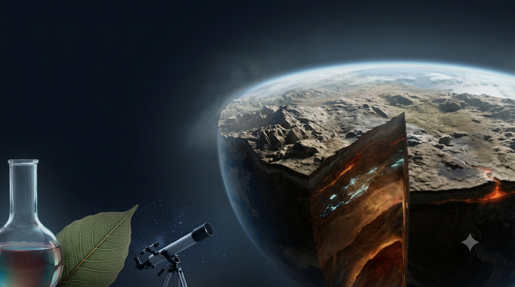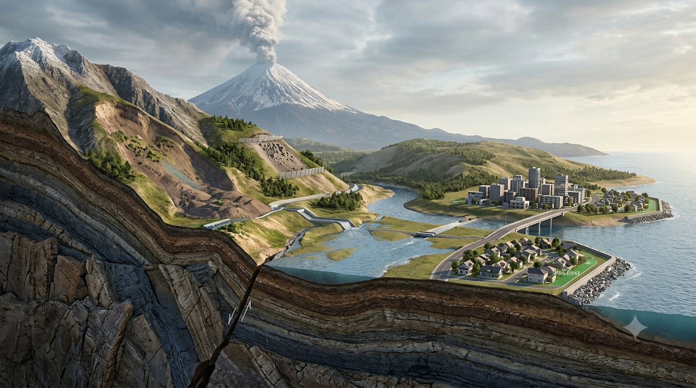
Natural hazards such as earthquakes, volcanic eruptions, landslides, floods, and coastal erosion can cause serious damage to people, buildings, infrastructure, and the environment. Although these events are part of Earth’s natural processes, their effects on communities can vary greatly depending on where people live and how well they are prepared. Geology plays an important role in understanding these hazards because it examines Earth’s structure, materials, processes, and history. By studying rocks, minerals, soil, landforms, and movements within Earth’s crust, geologists can identify areas that may be vulnerable to natural disasters. Their research helps scientists understand why hazards occur, recognize warning signs, assess risks, and support safer land-use planning. Geology cannot prevent every natural disaster, but it provides valuable knowledge that helps communities reduce damage, protect lives, and prepare for future events.
What Is Geology and Why Does It Matter?
Geology is the scientific study of Earth, including its composition, structure, history, and the physical processes that shape its surface. It helps explain how mountains form, why continents move, how volcanoes develop, and how landscapes change over time.
The ground beneath our feet may appear stable, but Earth is constantly changing. Tectonic plates move, rocks fracture, rivers erode their banks, groundwater flows through underground layers, and slopes gradually weaken. These processes can sometimes create hazardous conditions.
For example, a region located near an active fault may experience earthquakes. A settlement built on loose, water-saturated sediments may suffer severe ground shaking or liquefaction during an earthquake. Similarly, a village located below an unstable mountain slope may face landslide risks during heavy rainfall.
Geologists study these conditions to understand how hazards develop and where their effects may be most severe. Their findings help governments, engineers, emergency planners, and local communities make informed decisions about safety.
How Geology Helps Explain Earthquakes
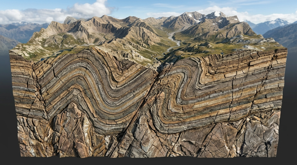
Earthquakes occur when accumulated stress within Earth’s crust is released suddenly, producing seismic waves that travel through the ground. Most earthquakes are associated with movements along faults, which are fractures in Earth’s crust where rocks move relative to one another.
Understanding Tectonic Plates and Faults
Earth’s outer shell is divided into large tectonic plates that move slowly over the underlying mantle. These plates interact at boundaries where they collide, separate, or slide past each other. Their movements can create stress in surrounding rocks.
When the stress becomes greater than the strength of the rocks or the friction holding a fault in place, the rocks can slip suddenly. This movement releases energy in the form of an earthquake.
Geologists map active faults, study the history of past earthquakes, and examine the types of rocks found in affected regions. These investigations help identify areas where damaging earthquakes are possible.
Identifying Areas Vulnerable to Ground Shaking
Not all locations experience an earthquake in the same way. The geological materials beneath a building can strongly influence how the ground responds to seismic waves.
Hard bedrock often behaves differently from loose sediments. Soft, unconsolidated materials can amplify certain types of ground shaking. In water-saturated sandy soils, strong shaking may cause liquefaction, a process in which the soil temporarily loses much of its strength and behaves more like a liquid.
Geological maps help engineers identify these conditions before construction begins. Buildings in earthquake-prone regions can then be designed according to appropriate seismic standards, while critical facilities can be located and reinforced with ground conditions in mind.
How Earthquake Geology Protects Communities
Geological research contributes to earthquake hazard maps, which show areas where strong shaking, surface faulting, or liquefaction may occur. These maps support safer construction, infrastructure planning, and emergency preparation.
Although geologists cannot predict the exact time and location of most earthquakes, they can assess long-term seismic hazards. Combined with seismic monitoring, building regulations, public education, and emergency planning, this knowledge can significantly reduce earthquake-related losses.
How Geology Helps Understand Volcanic Eruptions
Volcanoes form when molten rock, gases, and other materials reach Earth’s surface. They are commonly associated with tectonic plate boundaries and certain regions above mantle hotspots.
Volcanic eruptions can produce lava flows, ash clouds, toxic gases, pyroclastic flows, and lahars. These hazards differ in speed, temperature, distance traveled, and potential damage.
Studying Magma and Volcanic Structures
Geologists examine the composition of volcanic rocks, the structure of volcanoes, and the distribution of past deposits to understand how a volcano has behaved over time.
The chemical composition and physical properties of magma influence its viscosity and how easily gases can escape. Some magma allows gases to escape relatively easily, while other magma can trap gases and contribute to explosive eruptions.
Researchers also study changes in a volcano’s shape, ground deformation, gas emissions, and earthquake activity. Such changes may indicate that magma is moving beneath the surface.
Mapping Volcanic Hazards
A volcano’s previous activity provides important clues about the hazards it may produce in the future. Geological investigations identify areas that could be affected by lava flows, falling ash, pyroclastic flows, or volcanic mudflows.
For example, communities located along river valleys near a volcano may be vulnerable to lahars, which are fast-moving mixtures of water, volcanic ash, rock fragments, and other debris. These flows can travel far beyond the volcano itself.
Hazard maps help authorities plan evacuation routes, restrict construction in particularly dangerous areas, and identify safer locations for schools, hospitals, and emergency shelters.
Geology cannot guarantee that an eruption will be predicted in time, but it improves understanding of volcanic behavior and supports monitoring systems that can provide warnings.
How Geology Explains Landslides
Landslides occur when rock, soil, or debris moves downhill under the influence of gravity. They can develop suddenly or gradually and may be triggered by heavy rainfall, earthquakes, volcanic activity, erosion, or human activities.
Geology is especially important in mountainous regions, hilly settlements, road construction zones, and areas where slopes have been modified.
Understanding Slope Stability
The stability of a slope depends on several factors, including the strength of its materials, the angle of the slope, the presence of fractures, vegetation, and the amount of water in the ground.
Some rock layers are strong and resistant to movement, while others are weak, weathered, or easily broken. If weak layers lie beneath stronger rocks, the slope may become unstable, particularly when water enters the ground.
Water can increase the weight of slope materials and raise pore-water pressure, reducing the friction that helps hold particles together. As a result, heavy rainfall may trigger a landslide in an already vulnerable area.
Geologists examine rock layers, fractures, soil conditions, groundwater, and previous landslide deposits to determine why a slope may fail.
Reducing Landslide Risks
Geological surveys can identify unstable hillsides before roads, houses, or other infrastructure are constructed. Where risks are significant, authorities may restrict development, improve drainage, stabilize slopes, or install monitoring instruments.
Retaining structures, rock bolts, protective barriers, and suitable vegetation may help in particular situations, depending on the type and cause of instability. However, no single solution works for every slope.
In vulnerable communities, geological assessments are especially useful before the monsoon season. Combining slope monitoring, rainfall information, evacuation planning, and public awareness can help reduce the danger from landslides.
How Geology Helps Explain Floods
Flooding occurs when water covers land that is normally dry. It can result from intense rainfall, overflowing rivers, storm surges, rapid snowmelt, or the failure of dams and other water-control structures.
Floods are influenced by weather, but geology also affects how water moves across and through the landscape.
The Role of Rocks, Soil, and Landforms
Different geological materials absorb and transmit water at different rates. Permeable materials, such as some sands and gravels, allow water to infiltrate relatively easily. Less permeable materials, including many clays and certain solid rock formations, can restrict infiltration.
When rainfall exceeds the capacity of the ground to absorb water, more water flows over the surface and may enter streams and rivers. The shape of a drainage basin, the steepness of slopes, and the arrangement of river channels also influence how quickly water reaches downstream areas.
Geologists study river valleys, floodplain sediments, ancient river channels, and deposits left by earlier floods. These features can reveal locations that have experienced flooding in the past, even if they have not flooded recently.
Using Geological Information for Flood Protection
Floodplain mapping helps communities recognize areas naturally exposed to overflowing rivers. It supports decisions about where to build homes, schools, hospitals, roads, and other essential infrastructure.
Geological and hydrological studies can also help explain why flooding occurs repeatedly in particular locations. For example, a settlement may occupy an old river channel or a low-lying floodplain that naturally collects water.
Flood risk can be reduced through suitable land-use planning, drainage improvements, flood barriers where appropriate, wetland protection, and early-warning systems. Geological evidence helps authorities understand the landscape in which these measures must operate.
However, geology alone cannot determine the full extent of a future flood. Accurate assessments also require rainfall forecasts, river-flow measurements, land-use information, and climate data.
How Geology Helps Explain Coastal Hazards
Coastal communities face several natural hazards, including coastal erosion, storm surges, shoreline instability, and tsunami inundation. Geological studies help explain why coastlines change and which locations may be especially vulnerable.
Coastal Erosion and Changing Shorelines
Waves, currents, tides, and storms continuously move sediment along coastlines. Some beaches gain sand, while others lose it. Rocky coastlines may gradually develop cliffs, caves, and other landforms through erosion.
The type of rock or sediment along a coast influences how quickly it wears away. Soft sediments and weak rocks generally respond differently to wave action than strong, resistant rock formations.
Geologists study coastal deposits, historical shoreline positions, sediment movement, and changes in coastal landforms to understand erosion patterns. This information helps communities evaluate whether buildings, roads, and other structures are at risk from shoreline retreat.
Understanding Tsunami Hazards
Tsunamis are usually caused by sudden displacement of large volumes of seawater, often following powerful undersea earthquakes. They can also result from certain submarine landslides and volcanic events.
Geologists examine evidence of ancient tsunamis, including unusual sand layers, marine sediments deposited inland, and changes in coastal landforms. Such evidence can reveal that a coastline experienced destructive waves long before modern records began.
Tsunami hazard maps help identify low-lying areas that may be inundated. Authorities can use this information to establish evacuation routes, mark safe zones, educate residents, and plan emergency drills.
Protecting coastal communities also requires tsunami detection systems, timely warnings, and public understanding of natural warning signs, such as strong or prolonged coastal earthquake shaking or an unusual sudden change in sea level.
How Geology Helps Explain Soil Erosion and Ground Subsidence
Some geological hazards develop slowly but can eventually cause substantial damage. Soil erosion and ground subsidence are two important examples.
Soil Erosion
Soil erosion occurs when water, wind, or other forces remove the upper layers of soil. It can reduce agricultural productivity, increase sediment in rivers, and contribute to slope instability.
Geology helps explain how soil develops from weathered rock and why some materials are more easily eroded than others. The arrangement of rock layers, soil texture, slope steepness, and drainage patterns all influence erosion.
This information supports soil conservation practices such as maintaining vegetation, protecting drainage channels, using appropriate farming methods, and managing construction activities.
Ground Subsidence
Ground subsidence is the gradual or sudden sinking of the land surface. It may occur when underground cavities collapse, groundwater is extracted excessively, or weak underground materials compact under pressure.
In some regions, limestone dissolves in groundwater and creates underground cavities. The collapse of a cavity near the surface can produce a sinkhole. In other locations, excessive groundwater pumping causes sediments to compact, leading to land sinking and damage to buildings, roads, and pipelines.
Geologists investigate underground rock formations, groundwater conditions, mining activity, and the structure of subsurface layers to identify potential causes.
Monitoring groundwater levels, regulating extraction, surveying the ground, and assessing underground conditions before construction can help reduce these risks.
Geological Tools Used to Study Natural Hazards
Modern geology combines field observations with laboratory analysis, remote sensing, mapping, and digital technology. These tools help scientists understand hazardous processes and communicate their findings to communities.
Geological Mapping
Geological maps show the distribution of rock types, faults, sediments, and other features. They help identify areas where certain hazards may be more likely or where the ground may behave differently during an event.
For example, maps of active faults can support earthquake hazard assessments, while maps of unstable slopes can guide landslide prevention efforts.
Remote Sensing and Satellite Images
Satellites and aerial surveys allow scientists to observe large areas and detect changes that may be difficult to identify from the ground.
Remote sensing can reveal landslide scars, changes in coastlines, volcanic deformation, flood extent, and land subsidence. Repeated observations allow researchers to compare conditions over time.
Geographic Information Systems
Geographic Information Systems (GIS) combine spatial information from geological maps, satellite images, population records, roads, buildings, and other sources.
Scientists can use GIS to identify where natural hazards overlap with populated areas or important infrastructure. For example, a landslide hazard map can be combined with road locations to identify routes that may be vulnerable during heavy rainfall.
Ground Monitoring and Geophysical Surveys
Scientists use instruments such as seismometers, GPS receivers, inclinometers, and ground-based radar to measure movements and changes in the Earth’s surface.
Geophysical methods, including seismic surveys and electrical resistivity measurements, can help investigate underground structures without extensive excavation.
These techniques provide information about faults, groundwater, unstable slopes, and hidden geological features. Their effectiveness depends on the hazard being studied and the quality of the available data.
How Geological Knowledge Supports Disaster Risk Reduction
Understanding natural hazards is only the first step. Geological information becomes most valuable when it is used to reduce exposure, improve preparedness, and protect vulnerable communities.
Safer Land-Use Planning
Authorities can use geological assessments to identify areas where development may be dangerous. Avoiding construction on active fault traces, unstable slopes, highly flood-prone land, or areas exposed to coastal inundation can reduce future losses.
Where development is necessary, appropriate engineering standards and risk-reduction measures can help make buildings and infrastructure safer.
Better Building Design
Engineers rely on geological investigations to understand the strength and behavior of the ground beneath proposed structures. Information about bedrock depth, soil conditions, groundwater, and slope stability helps determine suitable foundations and construction methods.
In earthquake-prone regions, seismic design standards are particularly important. In landslide-prone areas, drainage and slope-stability measures may be necessary.
Early-Warning Systems and Emergency Planning
Geological research contributes to the development of hazard maps and monitoring systems that support warnings and emergency decisions.
For example, changes in volcanic activity may contribute to an alert, while rainfall measurements combined with slope conditions may help identify possible landslide danger. Seismic monitoring and tsunami detection systems can also support rapid emergency responses.
An early warning is useful only when it reaches people in time and explains what action they should take. Communities need clear communication, accessible evacuation routes, and regular emergency drills.
Community Education
People who understand local hazards are better prepared to respond appropriately. Geological education can explain why certain areas are unsafe, what natural warning signs may indicate danger, and why evacuation instructions should be followed.
Schools, local authorities, community organizations, and emergency services can use geological maps and practical demonstrations to improve public awareness.
Community participation is especially important because local residents often have valuable knowledge of previous floods, slope failures, coastal changes, and other events.
The Role of Geology in India
India experiences a wide range of natural hazards because of its varied geology, climate, topography, and coastline. Geological knowledge is important for managing risks in the Himalayas, the Indo-Gangetic plains, volcanic and earthquake-related regions, and coastal areas.
Earthquakes in the Himalayan Region
The Indian plate continues to move toward the Eurasian plate, contributing to tectonic activity and earthquake hazards in the Himalayan region.
Geological investigations help scientists study active faults, past earthquakes, and the structure of mountain rocks. This knowledge supports seismic hazard assessments and safer infrastructure planning.
Landslides During the Monsoon
Heavy monsoon rainfall can trigger landslides in the Himalayas, the Western Ghats, and other hilly regions. Road cutting, deforestation, poorly managed drainage, and construction can increase instability in some locations.
Geological surveys help identify vulnerable slopes and inform decisions about road alignment, slope stabilization, drainage, and development restrictions.
Flooding in River Basins
Major river systems can experience flooding during periods of intense rainfall. Geological studies of river channels, floodplains, sediment deposits, and drainage basins help identify areas exposed to repeated inundation.
This information can support floodplain management and decisions about settlements and infrastructure.
Coastal and Tsunami Hazards
India’s long coastline is exposed to coastal erosion, cyclones, storm surges, and tsunami hazards. Geological studies of coastal sediments, shoreline changes, and past tsunami deposits contribute to coastal risk assessments.
These investigations are most effective when combined with weather forecasting, ocean monitoring, engineering, and community preparedness.
Limitations of Geological Hazard Prediction
Although geology greatly improves our understanding of natural hazards, it cannot eliminate uncertainty. Earth processes are complex, and the available evidence may be incomplete.
For example, scientists can identify active faults and estimate earthquake probabilities, but they generally cannot predict the exact time, place, and magnitude of an individual earthquake. Similarly, geological evidence can reveal areas vulnerable to landslides without determining the precise moment when a slope will fail.
Hazard maps also depend on the quality of geological surveys, monitoring records, and scientific models. Environmental changes, urban development, and climate-related changes in rainfall can alter the conditions under which hazards occur.
For these reasons, geological assessments should be updated as new information becomes available. Effective disaster management requires cooperation among geologists, engineers, meteorologists, hydrologists, urban planners, emergency services, and local communities.
Conclusion
Geology plays a vital role in explaining natural hazards and helping communities prepare for their effects. By studying Earth’s structure, rocks, soils, faults, landforms, and geological history, scientists can identify hazardous areas and understand the processes responsible for earthquakes, volcanic eruptions, landslides, floods, coastal erosion, and ground subsidence. Geological maps, satellite observations, ground monitoring, and computer-based risk assessments provide valuable information for safer construction, responsible land-use planning, and emergency preparedness. Although geology cannot prevent every natural event or predict every disaster precisely, it helps people make better decisions before, during, and after hazardous situations. When geological knowledge is combined with engineering, early-warning systems, public education, and effective governance, communities become better equipped to reduce damage, protect lives, and build a safer future.
FAQs
1. What is the role of geology in understanding natural hazards?
Geology helps scientists understand the natural processes that cause earthquakes, volcanic eruptions, landslides, floods, coastal erosion, and ground subsidence. By studying rocks, soil, faults, landforms, and Earth’s history, geologists identify areas that may be vulnerable to these hazards. They also examine evidence of past geological events to understand how frequently certain hazards have occurred and how severe their effects may be. This information supports hazard mapping, safer construction, land-use planning, and disaster preparedness. Although geology cannot prevent every natural hazard, it provides essential scientific knowledge that helps communities reduce risks, protect infrastructure, and save lives.
2. How do geologists help predict earthquakes?
Geologists study active faults, tectonic plate movements, rock deformation, and evidence of previous earthquakes to understand seismic hazards. They investigate how stress accumulates along faults and use geological records to estimate the likelihood of future earthquakes over particular periods. Seismologists complement this work by monitoring ground vibrations and analyzing seismic activity. Geological maps also help identify areas where strong shaking or soil liquefaction may occur. However, scientists cannot reliably predict the exact time, location, and magnitude of an individual earthquake. Instead, geological research supports long-term hazard assessments, earthquake-resistant construction, emergency planning, and public awareness to reduce potential damage.
3. How does geology help protect people from volcanic eruptions?
Geology helps scientists understand volcanic activity by examining volcanic rocks, magma composition, underground structures, and deposits from previous eruptions. These investigations reveal the types of hazards a volcano may produce, including lava flows, ashfall, pyroclastic flows, and lahars. Geologists also help create volcanic hazard maps that identify areas potentially affected by different eruptive processes. When geological studies are combined with monitoring of earthquakes, gas emissions, and ground deformation, scientists can recognize changes that may indicate increasing volcanic activity. This information supports evacuation planning, land-use decisions, and public warnings, helping authorities reduce risks to nearby communities.
4. Why are some areas more vulnerable to landslides than others?
Some areas are more vulnerable to landslides because of their steep slopes, weak rocks, loose soil, fractured geological layers, and groundwater conditions. Heavy rainfall can increase the weight of slope materials and raise water pressure within the ground, making slopes less stable. Earthquakes, erosion, road construction, and poorly managed drainage can also contribute to slope failure. Geologists examine rock structures, soil properties, slope angles, and evidence of previous landslides to identify dangerous locations. Their findings help authorities plan safer roads and settlements, improve drainage, stabilize vulnerable slopes, and establish monitoring or evacuation measures where necessary.
5. How does geology contribute to flood prevention?
Geology helps explain how water moves through soil, rocks, river channels, and drainage basins. Permeable materials can allow water to infiltrate the ground, while less permeable surfaces may encourage greater surface runoff under suitable conditions. Geologists also study floodplain sediments, ancient river channels, and deposits from previous floods to identify areas that may be exposed to future inundation. This information supports flood hazard mapping, safer urban planning, and the protection of natural drainage systems. Geology cannot prevent every flood, but it helps communities understand the landscape and make informed decisions when combined with rainfall forecasts, hydrological studies, and effective flood management.
6. What geological factors influence coastal hazards?
Coastal hazards are influenced by rock type, sediment composition, shoreline shape, underwater topography, and the movement of sediment by waves and currents. Soft sediments and weak rocks may erode more easily than resistant rock formations. Geological studies help scientists identify areas experiencing shoreline retreat and understand how coastlines have changed over time. Researchers also investigate ancient tsunami deposits and other evidence of past coastal disasters to estimate where destructive waves may have reached. This information supports coastal hazard mapping, development planning, evacuation routes, and protective measures. Combining geology with ocean monitoring and weather forecasting improves the ability to manage coastal risks.
7. What tools do geologists use to study natural hazards?
Geologists use several tools to investigate natural hazards. Geological maps show the distribution of rocks, faults, sediments, and other important features. Satellite images and remote sensing help detect landslides, volcanic deformation, shoreline changes, and land subsidence. Geographic Information Systems combine geological information with population, infrastructure, and terrain data to identify vulnerable locations. Instruments such as seismometers measure ground vibrations, while GPS receivers and inclinometers help monitor ground movement. Geophysical surveys can reveal underground structures without extensive excavation. By combining these tools with field observations and historical records, scientists develop more reliable hazard assessments and provide information for disaster risk reduction.
8. How does geological knowledge improve disaster preparedness?
Geological knowledge improves disaster preparedness by helping communities understand which hazards may affect their locations and what conditions increase their vulnerability. Hazard maps can guide evacuation planning, building regulations, and the placement of essential infrastructure. Geological investigations also help identify unstable slopes, active fault zones, flood-prone areas, and coastlines exposed to erosion or tsunami inundation. Authorities can use this information to establish monitoring systems, prepare emergency plans, and educate residents about appropriate safety measures. When geological assessments are combined with effective communication, regular emergency drills, and reliable warning systems, communities can respond more quickly and reduce injuries, property damage, and disruption.
9. How does geology help reduce natural disaster risks in India?
Geology helps India manage earthquake, landslide, flood, and coastal hazards by identifying vulnerable locations and explaining the processes that create these risks. In the Himalayas, geological studies investigate active faults, unstable mountain slopes, and earthquake hazards. In the Western Ghats, slope assessments help identify areas vulnerable to rainfall-triggered landslides. Studies of river channels and floodplain sediments support flood risk management, while coastal investigations help assess erosion and tsunami exposure. Geological information also guides infrastructure planning and construction practices. When combined with weather forecasting, engineering, monitoring, and community awareness, these efforts can reduce disaster impacts across India’s diverse landscapes.
10. Can geology completely prevent natural disasters?
No, geology cannot completely prevent natural disasters because earthquakes, volcanic eruptions, floods, and other hazardous events are part of Earth’s natural processes. Scientists also face limitations when predicting exactly when and where some events will occur. However, geology can help reduce the risks and consequences associated with these events. By identifying vulnerable areas, examining past disasters, mapping geological conditions, and monitoring changes in the Earth’s surface, scientists provide information that supports safer construction and emergency planning. Combining geological research with early-warning systems, public education, environmental management, and effective government policies can significantly reduce casualties, property damage, and long-term disruption.